2.2 HISTORICAL SUMMARY THE DEVELOPMENT OF THE LITHGOW REGION
The development of the Lithgow region is associated with two main activities, the construction of a road across the Blue Mountains from Sydney to Bathurst between 1815 and 1830 and the subsequent construction of a rail line to connect these two areas in the 1860s and1870s.
Associated with these two activities are two distinct forms of settlement. The first, associated with the development of the road, are the small towns of Bowenfels, Hartley and Hartley Vale. These towns were focused on the road to Bathurst and developed from a number of inns which were constructed to service the travellers along this road. The first inn in the area was Collit's Inn at Hartley Vale which was constructed in 1823. Subsequent development was to occur at Bowenfels, with the construction of a number of inns along the main road from 1832 (Cremin, et al, p3).
The character of the area at this time was predominantly pastoral and characterised by a small number of large land holdings such as Wallerawang,Cooerwull, the Hermitage and Esk Bank, which were settled by the Scottish immigrants James Walker, Andrew Brown, the Reverend Colin Stewart and Thomas Brown respectively.
The second form of settlement, which began with the passing of the Sydney to Bathurst rail line through the region, was characterised by the industrialisation of the Lithgow township. The activities of Thomas Brown at Esk Bank, saw the first movement toward industrialisation of the town of Lithgow. He successfully established a flour mill on his property to process the wheat grown on his land as well as the wheat of the people within the region. Brown is reputed to have been the first person to mine coal within the area, with reports indicating that Brown was exploiting the local coal seams to power his mill in 1860(Cremin, etal 1987, p3).
The main impetus for the industrialisation of Lithgow was provided by a political contrivance which saw the main rail line passing directly through Thomas Brown's Esk Bank property. This provided Brown with the opportunity to supply the New South Wales Department of Railways with an available source of steaming coals to supply its steam engines.
The continued demand for coal by the New South Wales Railways provided the catalyst for the further development of the Lithgow coal mining industry. This was reinforced by local mines gaining permanent contracts for the supply of coals to the railways. The Esk Bank Colliery operated by Thomas Brown, the Hermitage Colliery sited on Colin Stewart's Hermitage Estate, and the Lithgow Valley and Vale of Clwydd Collieries each began to increase their production during the 1870s to meet government demands (Cremin, et al, p5). In addition, the formation of the rail link to Sydney allowed coal won on the Western Coal Fields to be sent to Sydney and exported to other destinations.
By this time, the focus of development had shifted away from the township of Bowenfels toward Lithgow.
The industrialisation of Lithgow was given further impetus by the demands of the Railways for the supply of large quantities of iron rails. A source of iron ore located directly beneath the surface of the ground was found at Lithgow and resulted in various attempts to mill both iron and steel in the area.
The first attempt to mill iron at Lithgow was made by James Rutherford. However his activities were frustrated by a number of technical difficulties as well as competition from cheap iron imports which were to brought to Australia as ballast in the holds of cargo ships.
After blowing up his blast furnace in a mark of frustration,Rutherford's activities were taken over by William Sandford, who successfully puddled steel at Esk Bank in 1900. After experiencing difficulties in financing his operations, Sandford's operations were to eventually pass into the ownership of George and Charles Hoskins who turned to the Lithgow works into a viable operation. The success of the Hoskins Brothers was sealed through their ability to gain government support for domestic produced iron and steel over imported product. The Brothers were successful in winning numerous government steel contracts including contracts to supply the Railways with steel for rail lines.
A third industry to develop in the Lithgow region was Copper Smelting. The first smelting in the area was undertaken by a Welshman by the name of Lloyd with ores won at Wisemans Creek and smelted from the coal slack from Thomas Brown's colliery. Two further copper plants were also to develop in the area;the first in 1876 by the tobacco magnate Thomas Saywell and the second formed in 1895 by the Cobar Syndicate.
As a result of the availability of natural resources, and the areas' relative isolation, a Government decision was made in 1908for the construction of a Small Armaments Factory within Lithgow. This was to be a large contributor to the regional economy, with booms in production, and employment, occurring during the period of the two world wars.
Other major industries that developed around Lithgow at the time included Tweed Mills, the Lithgow Valley Potteries, Meat Refrigeration Works and Kerosene shale mining.
The strength of development in Lithgow was closely linked to the availability of abundant supplies of natural resources such as coal, iron ore, copper, kerosene shales and water resources as well as resources from the surrounding pastoral industries. Reporting on the ceremony to mark the first tapping of iron at Esk Bank the Lithgow Mercury on April27th 1900 noted,
'Mr. Sandford said they had visited the copper works, ....ironworks... and had seen the works destined to play an important part in the manufacturing industry of Australia...with abundant water supply, good raw materials... A tour back door was the great wheat, sheep, and cattle industry to feed thousands of men who would find constant employment in the Lithgow Valley' (cited in Brown, 1989,p68).
The development of the region was also fostered by individuals with an opportunistic spirit. Land was taken up in the area by individuals such as James Walker and Andrew Brown who acquired significant pastoral holdings from their properties in the region, extending their activities into the New South Wales and Queensland interiors. The activities of men such as Walker and Brown were instrumental in the development of Australia's pastoral industry.
Others such as Thomas Brown, recognised the opportunity provided by the abundance of local coal reserves, positioning themselves to take advantage of the requirements of the NSW Railways, and thereby securing Lithgow's role as a producer of coal and industrial city.
George and Charles Hoskins turned Lithgow's iron and steel making industry into a successful operation through their lobbying of the State and Federal Governments to support locally produced iron and steel. Their winning of government contracts for the production of iron and steel ensured the viability of the Lithgow industry, at least for the short-term.
The strength of Lithgow's industry however, has always been heavily reliant on government contract sand backing. The local coal industry was supported by contracts to the NSW Railways and for the supply of coal to the State Power Stations; the production of steel was reliant on contracts to the railways as well as other government contracts; the success of the Tweed Mills was linked to government contracts for the supply of Khakis to the Army and the Small Arms Factory was, and continues to be, reliant on government decision making processes.
This has resulted in a dependence of the region on both State and Federal governments and has meant that the region has been historically vulnerable to changes in government policy. The decision by the State government to phase out steam trains through the introduction of diesel locomotives and consequent reduction in state coal contracts, the fall off in demand for Army Khakis and progressive downsizing of the Small Arms Factory have had significant impacts on the regional economy.
The regional economy, which is largely focused on industrial production has over time, also been susceptible to the vagaries of international markets. The price of coal on international markets as well as the demand for coal have gone through ongoing periods of boom and bust since the development of the Lithgow coal mining industry. This has resulted in uncertainties in the regional economy with local resources such as housing and other services being in over supply during certain periods and under supply in others. This has ensured that the historic character of the local housing stock has been preserved but has also meant that the demands of the market have not always been fully met, with an historically high incidence of Lithgow workers commuting from both the Blue Mountains and Bathurst due to better housing stock.
A further impediment to the growth of the regional economy which has affected the region since its initial settlement in the early 1820s to the present date, is the barrier provided by the Blue Mountains. While the roads built by Cox and Mitchell, were heralded as engineering feats for their time, the steep and winding decent down Victoria Pass on low capacity roads has ensured continually high transportation costs for goods produced in the Lithgow Region.
Similarly, rail services provided to Lithgow were subject to the same high freight charges due to the costs of operating the system. The ZigZag System was largely ineffective in the movement of large quantities of coal as trains were limited in both their length, due to the zig-zag arrangement of the line, and weight due to the steep ascent. Such high transportation costs were instrumental in ensuring that the Hoskins Brothers were to move their Iron and Steel making operations from Lithgow to Port Kembla in the early 1930s and has seen in coals produced on the Northern and Illawarra fields being favoured over western coal due to relative transportation costs.
The further development of the regional economy is reliant on developing more efficient road and rail links between Lithgow and other major regions.
In spite of these limitations, the Lithgow Region should be seen as a place of valuable contrasts, it is surrounded by vast areas of wilderness such as the Kanangra Boyd and Wollemi National Parks, it provides a well preserved record of Australia's colonial past, particularly in areas such as Hartley and has strong linkages to early Australian pastoral and exploration activities in areas such as Bowenfels and Wallerawang. The town of Lithgow itself, is an important icon which relates to the industrialisation of Australia. The area is rich in industrial history and provides an important resource in developing an understanding of the industrialisation of Australia. The features of this region should be capitalised on to ensure the continued growth of the region.
THE SHAMROCK AND THISTLE:
A POTTED HISTORY OF THE RISE AND FALL OF AN INDUSTRIAL TOWN
WILLIAM LITHGOW
The town of Lithgow was named after William Lithgow by Surveyor-General John Oxley.
Lithgow was born in Scotland in 1784 and educated at Edinburgh University, graduating as a licentiate of the Church of Scotland. Arriving in the colony in 1820, Lithgow's first position was as Assistant Commissary-General. He was to hold a variety of other administrative positions in colony including Auditor-General for the colony's accounts under Governor Brisbane and private secretary to Governor Darling.
Lithgow was appointed as a member of the Legislative Council under Governor Darling and served as the government nominee to the 1843Parliament, retiring from Parliament in 1856 with the introduction of Responsible Government.
EXPLORATION
The early development of the Lithgow region is inextricably linked to the successive attempts to cross the Blue Mountains and the exploration of the NSW colony.
Attempts to cross the mountains were fuelled by the need to find new grazing lands for the government herds.
The successful crossing of the Blue Mountains in 1813 by Blaxland, Lawson and Wentworth enabled the lands west of the Great Dividing Range to be opened up for exploitation, particularly for pastoral development.
Blaxland, Lawson and Wentworth's route across the Blue Mountains was surveyed by the Government Surveyor Evans in 1814 and in the following year, Governor Macquarie commissioned William Cox to superintend the construction of a cart road following Evan's route. A party of 28 convicts were supplied to Cox to construct the 12foot wide road across the mountains. The party set out on the 18 July 1814to begin construction of the mountain crossing.
On reaching One Tree Hill, or what is now known as Mount Victoria, Cox decided to take the road behind Mount York as the descent from Mount Victoria was far too steep. This section of the road was named by Macquarie as Cox's Pass. Ruins of this section of road down Mount York can still be seen as can the abutments of the first bridges built by Cox at Glenroy, crossing the River Lett and the Cox's River.
Cox's road to Bathurst was completed by 1815, taking just six months to complete.
The land at the bottom of Mount Victoria was named the Vale of Clwydd symbolising its status as the gateway to the west and a line of rock to the north was named Hassan's Wall due to its semblance to Hassan's Wall in India.
Further development of the road
Cox's road down Mount York was found to be far too steep with many carriage shaving to be weighted at the back to stop them from hurtling down the mountain. In 1815 a reward of 1,000 acres was offered to anyone who could suggest a better route for the road.
In 1830 Major Thomas Mitchell was given charge of a party to complete the new road with instructions based on a route suggested by Collit, an early resident of the Lithgow area. Collit's suggestion, however was ignored by Mitchell who decided to build the road straight down Victoria Pass.
In 1831 there were approximately 800 men serving in ironed gangs in the Lithgow area, this had risen to 1,000 by 1836, falling to 700 by 1837(Winchester 1977, p6). The gangs were principally responsible for work on the roads between Sydney and Bathurst.
Three stockades were built to house the ironed gangs in the Lithgow area: at Hassans Walls, Bowenfels and the Cox's River at Mount Walker.
On December 1 1832, the Currency Lad reported that:
'The works at Victoria (Mt Victoria) having been completed so far as to render the new line available for all description of traffic, was thrown open to the public immediately after His Excellency the Governor (Governor Bourke) had gone over this new pass, upon his late tour to Bathurst, and the settlers of that place now derive the most essential advantage, especially the great wheat growers, who are at this season busily engaged, pouring their weighty valuable loads to Sydney for shipment, and whose teams are now enabled to ascend this stupendous mountain with comparative ease to what they had to encounter on the old and dangerous route by Mount York; the distance likewise is shortened by several miles. The declivity has been wrought at by one foot in twenty five, assimilating, as near as practicable, to the scale of road-making adopted by the late enterprising Napoleon over the Pyrenees Mountains'.
While Cox's and later Mitchell's roads were seen as significant engineering achievements for their day, they have provided an ongoing impediment to the success of the development of the Lithgow area. The steep grades and limited capacity of the roads into Lithgow have meant that the produce of the area, whether it was wheat hauled to the Sydney markets in the early 1800s or the iron, steel and coal resources which began to be developed later in that century, have always suffered a significant transportation disadvantage against other markets which are serviced by roads with better carrying capacity.
EARLY DEVELOPMENT
The first form of settlement within the region occurred at Bowenfels. The township of Bowenfels developed from Collit's Inn,which was built in 1823 as a stopover point for travelers on the Sydney to Bathurst road. Collit's Inn was situated at the bottom of the pass on Cox's Road and included a site for the protection of Government herds, however it was found that the site was too cold and the herd was subsequently moved to Glenroy. Further development, including a number of other inns such as the Glasgow Arms, as well as local industry to support travelers, progressively developed along the road.
The settlement of the region was characterised by a strong Scottish influence with each of the four of the early landholders: James Walker, Andrew Brown, Colin Stewart and Thomas Brown being of Scottish decent.
Andrew Brown
The first land adjacent to the Lithgow Valley to be settled was by Andrew Brown at Bowenfels between 1824 and 1826. Brown had travelled from his home in Methven, Perthshire, Scotland to manage James Walker's property at Wallerawang. Brown applied for 200 acres of land situated west of the current Lithgow Park to Cooerwull Brook (now Farmers Creek).The property was named Cooerwull after a small blue-bell like flower that grows in the region.
In 1837 Brown established a flour mill at Cooerwull to process wheat grown on his property and from the surrounding district. The mill which was situated on Cooerwull Brook was initially driven by a water wheel and was subsequently converted to steam in 1851. In 1867 the mill was converted to allow for the manufacture of woollen tweeds. The manufacture of tweed at this site continued until1973.
It is likely that Brown was the first to discover and utilise coal in the Lithgow Valley, with records suggesting that he was cutting coal to run his mill in the early 1860s (Cremin etal 1987, p3)
Brown also built a church and school hall at Cooerwull, now the De La Salle Academy. The school, which functioned as an academy for boys was capable of accommodating up to 80 pupils at a time. He was also responsible for building Methven, named after his home town, for his son John Laurence. Methven was completed in 1878 (Cremin etal, p.30). The current Bowenfels Presbyterian Church was also built by Brown as a school hall for children of itinerant railway workers as a gesture of philanthropy.
James Walker
Brown journeyed to Australia with James Walker are tired marine officer who settled further to the north west at a property that he named 'Wallerowang' (sic). Walker was to develop considerable holdings across both New South Wale sand Queensland using Wallerowang, managed by Andrew Brown, as a base for his pastoral operations.
Records suggest that Walker took up his land of 2,000 acres in1822, but was to significantly increase his holdings over time . In 1844 Governor Gipps wrote to Lord Stanley:
'by a return received only yesterday I find there is an individual in the Bligh district who holds 27 stations under a single license, Mr James Walker of Wallerowang. The Commissioner returns his run as having 5,184,000 acres, but I conclude that the greater part of it must consist of barren or mountains land. The individual has 3,000 head of cattle and 13,000 sheep and pays no more rent for the land they feed on than is paid by another person in the same district who holds only12,200 acres and has 1,000 cattle' (cited in Winchester 1972p,3)
Walker had brought eighteen merino sheep with him on the journey to Australia and agricultural implements to work the land. On experiencing the severity of the winters at Wallerawang and losing several sheep, Walker applied to the Colonial Secretary to increase his land to ensure that his stock could be moved to more appropriate conditions during the colder months. He firstly applied for land west of the Macquarie River and then at Bathurst,after being unsuccessful at these claims, he extended his lands to Wolgan and Loowee through squatting on these lands. By 1844 Walker is known to have held at least 1,1,184, 000 acres while only acknowledging 382,000 acres (Winchester 1972, p4)
In his historic voyage, Charles Darwin visited Walker's property on his way through to Bathurst. Darwin has provided an account of this visit in his diary, 'The Voyage of the Beagle'. An issue that struck Darwin, was the obvious absence of women in the area, remarking in his journal that
'Although the farm was well stocked with every requisite, there was an apparent lack of comfort; and not even a single woman resided here. The sunset of a fine day will generally cast an air of happy contentment on any scene; but here, at this retired farm-house, the brightest tints of the surrounding woods could not make me forget that forty hardened, profligate men, were ceasing their daily labours, like the slaves from Africa, yet without their just claim for compassion.'(Darwin 1839, pp524-26)
Walker had returned home to Scotland in 1834 to marry his cousin Robina who accompanied him back to Wallerawang. The Walkers had four children Allison, Wilhelmina, Archibald and Georgina Lyon Wolgan Walker. Georgina was to marry Edwin Barton, an engineer in charge of the construction of the ZigZag railway(Centenary History, St. John's Church, 1981). At this time the Walker Estate became known as the Barton Estate. They had two children Lyon and Loveday who lived together at the Barton Estate until 1948 when both were murdered by a disgruntled employee. The Barton Estate was taken over by the Joint Coal Board after their deaths.
Colin Stewart
In 1839 the first clergyman for the region, the Reverend Colin Stewart arrived in the Hartley Valley from Edinburgh. Stewart, a Presbyterian Minister took up130 acres next to Andrew Brown, in a property that he named The Hermitage(later to become the site of Lithgow's earliest coal mining operations). Stewart remained in the Lithgow area until 1873 (Cremin etal 1987, p25).
Thomas Brown
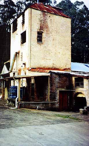
Thomas Brown and his wife Mary Maxwell took up approximately 400 acres in the Lithgow Valley around 1835 (Cremin etal1987, p25). The property was named Eskbank after the river Esk in Scotland. Brown was appointed as the Magistrate at the Courthouse at Hartley. He was also appointed to represent the district on the Legislative Assembly in 1872.After the death of Mary in 1878, Brown remained at Eskbank until 1884 where he returned to Sydney, dying in 1889.
Eskbank House is believed to have been built by Alexander Binning who was also the builder and owner of the Glasgow Arms.
After the death of Brown, Eskbank was purchased by William Sandford who was involved in the early development of Lithgow's iron and steel industry. From that time, the property was progressively taken over by the various owners of the steel works including the Hoskin Brothers and later the Australian Iron and Steel Company. The property was later renamed, The Grange and is situated opposite Mort's Estate.
THE RAILWAYS
The rail line from Sydney to Bathurst reached Lithgow in 1869and saw the focus of development shift from the road centred town of Bowenfels, toward Lithgow.
The requirements of the New South Wales Railways for supplies of good steaming coal, of which Lithgow had in abundance, and steel for the construction and maintenance of the rail network provided the catalyst for the industrialisation of Lithgow.
Lithgow was to develop as the rail-head for the western region. Two stations were built in Lithgow to service the development of the coal mines, blast furnaces and other industries. Esk Bank Station was positioned at one end of Main Street and Lithgow Station at the other. The line was then taken to Bowenfels and extended to Wallerawang and Rydal in 1870, eventually reaching Bathurst in1876. A further branch was also taken out toward Mudgee, with the first section to Capertee being completed in 1882.
A number of sidings were built off these main lines to provide access for the major collieries including the Wallerawang Colliery branch line, opened in 1924, the Cal Colliery siding and Vale of Clwydd Company siding both developed in 1927 and abandoned in 1931.
A critical factor in the construction of the line to Bathurst was the descent to the Lithgow Valley. It was eventually decided that a' ZigZag line would be constructed which would progress trains down the escarpment by a forward and backward (zig-zag) movement by specifically arranged grades and bridges.
One of the major limitations of the zig-zag system was that because the rail continually changed direction, the length of trains to use the line was limited. This limitation was to have long term implications in terms of the cost and viability of transporting goods from Lithgow and the surrounding district to coastal markets.
As demand for rail transport increased and the engines grew larger, the ZigZag became inadequate. This led, in 1910, to the construction of ten tunnels to allow movement of trains from Mount Victoria to the valley below. An additional station between the Lithgow and Esk Bank Stations was also constructed to provide greater convenience for the train passengers. The former zig-zag railway currently operates as a tourist attraction in Lithgow.
In 1951 the western rail line was electrified to Wallerawang ahead of mothballing and Newcastle line electrifications. Proposals by the NSW Railways associated with the electrification of the line were to provide a significant impetus, particularly for the development of Wallerawang. New town plans were drawn up for Wallerawang. This was to include large railway workshops and a power station to supply the railways. The power station was to be supported by the Newcom Colliery.
Political decisions ensured that the main electrified line did not go further than Lithgow. The railway workshops were, as a result,built at Lithgow and the plans for the town of Wallerawang were never brought to fruition.
Further, the decision in 1968 by the government to move the diesel workshops to Bathurst reduced the workshop operations in Lithgow. To compensate for this, the railway goods yards were increased at Lithgow at the expense of the yards at Wallerawang.
THE DEVELOPMENT OF THE TOWN
The demand for sources of steaming coal by the NSW Railways saw an increasing exploitation of coal resources in and around Lithgow and progressive development of the local coal industry. Supporting industries were also progressively developed as well as housing and local services. In the period between the railway reaching Lithgow and the turn of the century, Lithgow experienced a development boom, with the population increasing from 2,112 in 1881 to 5,268 in 1901 and 8,186 in 1911 (Cremin, etal 1986, p6).
Land was opened up for housing through the subdivision of the larger land holdings including Colin Stewart's Hermitage Estate in1895, Thomas Brown's Eskbank in 1911 and Andrew Brown's Cooerwull progressively between 1908 and 1918 (Cremin, etal 1986, p6).
A number of specific industrial activities were to develop in Lithgow and the surrounding region between the arrival of the rail line and World War I, these included continued development of coal mining operations; the development of the iron and steel industry; shale oil refining; copper smelting, the manufacture of tweed;the development of refrigeration works; and the local brickworks and pottery.
COALING
While coal deposits were accessible in many areas throughout New South Wales, proximity to markets and transport facilities saw the exploitation of coal resources limited to three distinct coal fields: the Newcastle fields, northern Illawarra and the Western fields, of which,Lithgow was a focal point. Coals found in the Newcastle Region were appropriate for producing gas and house coals, however these coals were of reduced value for steam coals and not appropriate for making metallurgical coke. Better coking and steam coals were found in the Illawarra and good steam coal found at Lithgow as well as limited quantities of coking coal (Jeans 1972, p303).
Early coal mining operations in Australia were restricted to the Hunter Region with mining activities undertaken by convict labour. Production was later taken over by the Australian Agricultural Company who acquired a monopoly in coal mining in 1827 and began to import skilled migrants principally from Northumbria and Scotland for mining activities.
Gradually the Australian Agricultural Company lost its monopoly over coal production and by 1849 there were six coal mines operating within the colony, producing at total of approximately 50,000 tons of coal (Jeans1972, p304). While coal output dropped off during the early 1850s due large numbers of workers heading for the gold fields, the increased demand for coal enabled higher wages to be paid to coal miners which served as incentive for many workers to stay at the coal mines. By 1861, New South Wales was producing 342,000 tons of coal with increased demand from Melbourne, who had no close source of coal supply at the time. Prices for coal rose significantly during this time from 78d per ton in 1850 to 168d per ton in 1861 (Jeans 1972, p304).
Coal mining was typically quite profitable, with output growing by 70% in the 1870s and further doubling in the 1880s (Jeans 1972, p304). The industry however was affected by price fluctuations, which typically resulted in reduced wages for miners. Such price fluctuations lead to the establishment of cartels designed to fix coal prices, for example one cartel operated from 1866 to 1869 and another, known as the Vend was established in 1873 and operated until prices of coal fell significantly during the 1880s (Jeans 1972, p304). Failure of these cartels was usually linked to some mining operations undercutting the cartel price.
A significant impetus to coaling industry was due to an increase in coal exports, with exports increasing from approximately half of total production in 1850 to two-thirds in the mid-1860s. (Jeans 1972, p.304).New South Wales coal for example was used by the British Admiralty in their steamships from the 1860s. Demand for coal also came as railways were being built in countries that bordered the Pacific, namely Japan and the American west coast. The development of the Australia rail network also provided a significant local impetus for coal producing operations.
Coal Mining in Lithgow
Lithgow lies in the centre of the Western Coalfield which extends in a north-westerly direction from Katoomba, through Hartley, Lithgow, Cullen Bullen and Kandos to Ulan near Mudgee, covering approximately 240kilometres. Most collieries are situated along the Sydney to Mudgee rail line.
There are six coal seams in the area: 'Katoomba' which is worked from Hartley; 'Irondale' which is worked from Wallerawang; 'Lidsdale' worked from Lidsdale and 'Lithgow' which is the most significant of all of the seams, and is worked from throughout the whole Western District. The coal won from these seams is typically used in steam production, for activities such as power plant usage.
It is reputed that the first coal in Lithgow was cut by Andrew Brown of Bowenfels with reports confirming that Brown was using coal for a steam engine at his flour mill from the 1850s (Cremin etal 1987, p3).
The coal seams around Lithgow were important for the development of the Great Western Railway, whose viability without this source of abundant coal reserves may have been doubtful.
Coal for trading purposes was first mined in 1868 by Mr. Pooleon the Hermitage Estate owned by the Reverend Colin Stewart.
Production at the Eskbank Colliery followed soon afterwards commencing operations in 1872 and producing 4,321 tons of coal. The Eskbank Colliery was developed by Thomas Brown with the original colliery sited behind the old Union Theatre.
In 1873 the Hermitage and Eskbank Collieries were the only mines selling coal within the district. Two other sites, however were soon to be developed as the Lithgow Valley Colliery, and the Vale of Clwydd Colliery established by the tobacco magnate Thomas Saywell.
Numerous coal mines have operated within the area including the Oakey Park Colliery Co. which operated between 1888 and 1941 and supplied electricity to Lithgow, the Great Cobar which supplied coal to the copper refining furnaces from 1899, the State Coal Mine opened by the New South Wales Railways in 1920, the Bowenfels/Tankersley Mine, the Steelworks Colliery and the Newcom Colliery established in 1951 to supply the Wallerawang Power Station.
Wallerawang Collieries
Coaling began in Wallerawang around 1873 with a number of mines being opened on the Lithgow seam at Mount Piper, mid-way between Wallerawang and Lidsdale.
The main mines at Wallerawang included:
The Irondale Colliery; Cullen Bullen Colliery; The Ivanhoe Colliery;
The Commonwealth Colliery; The Great Western Mine; and The Invincible Colliery.
Between 1900 and 1910 several small mines were also opened between Piper's Flat and Blackman's Flat including:
Black Diamond Mine (later known as Western Mine);Wallace's Colliery (later known as Huon); Neubeck's Mine; Springvale Colliery; The Commonwealth Colliery, which was the first open cut mine in New South Wales; Newcom Colliery; and The Angus Colliery,opened in 1978 after the Wallerawang Power Station was augmented with an additional two generators.
OTHER INDUSTRIES
The Lithgow Iron and Steel Industry
In October 1875 iron smelting began in Lithgow under the direction of Enoch Hughes. The foundry was erected on Thomas Brown's Esk Bank property where ore was found just beneath the surface of the ground.
Hughes successfully encouraged James Rutherford of Bathurst, a principal shareholder and manager of Cobb and Co., Dan Williams a Canadian railway engineer who had worked on the zig-zag and the Honourable John Sutherland the Minister for Public Works to join him in this steel making venture. By the end of 1876 the blast furnace was producing over 100 tons of pig-iron per week (Lithgow Public School 1947).
It was soon found that the success of the operation would be limited by cheap competition from overseas iron which was transported to the colony as ship's ballast. The mill carried on for some time under a co-operative system but appeared to have failed. In a mark of frustration at the lack of protectionist measures for local industries, Rutherford blew up the blast furnace with two dray loads of blasting powder (Brown 1989, p66).
William Sandford who was associated with the early steelmaking operations in Mittagong, took over the operations from Rutherford in1886 and made some initial successes in reviving the business by successfully puddling Australia's first steel in 1900. Sandford was a strong lobbyist for Lithgow industry, encouraging the New South Wales Government to exclusively use locally produced iron and steel. In 1904 the government sought tenders from America, Europe and Australia to supply it with its iron and steel requirements. A condition of the contract was that all operations had to use local ores and that all works needed to be located within New South Wales. Sandford was awarded the contract in 1907.
In order to meet the obligations of his contract, Sandford built a new blast furnace with a capacity of 1,000 tons per week the funds for which were secured through a significant bank overdraft (Brown 1989, p.74). The bank was to shortly foreclose on Sandford's loan, with the operations then passing to G & C Hoskins.
After George and Cecil Hoskins took over the Steel Works in 1908 the business began to thrive. In an attempt to make the local steel industry more viable, the Hoskins Brothers persuaded the government to pay a bounty for Australian produced steel. The Hoskins Brothers moved their operations from Rhodes in Sydney to Lithgow and began to make significant advancements.
Lithgow was to become renown for its steel production, with thousands of tons of steel being produced for the Trans-Australia Railway. In the first year of production, the Steel Works treated 51,000 tons of ore and employed632 people (Lithgow Public School 1947). By 1926 the steel furnaces had turned out 178,000 tons of ore,resulting in 105,000 tons of pig iron (Lithgow Public School 1947).
Coke and limestone were both necessary requirements for the production of steel. Coke was required to generate the required heat levels to smelt steel, and the limestone was required to act as a flux to draw off the impurities from the ore. The success of the Lithgow iron and steel industry was dependent on the supply of these two resources.
Limestone for the Lithgow operations was obtained from Ben Bullen, and Coke at Carcoar. The supply of metallurgical coke, however was not sufficient, and additional supply had to be freighted from the south coast at great cost. This cost was exacerbated by the state government's movement in 1919 to increase railway freight charges by 10% across the state (Brown 1989, p.83).
The lack of suitable coking coals, increases in railway freight charges and the inability of the Western District to supply sufficient quantities of good quality ore resulted in the demise of the Lithgow Iron and Steel industry. In 1932 the blast furnaces were removed from the site. The Hoskins Brothers at this time joined the Australian Iron and Steel Company and re-erected their steel works at Port Kembla.
Copper Smelting
Copper smelting in the Lithgow area was first commenced by Mr. L. Lloyd, a Welsh immigrant, in 1874. Ores for Lloyd's Eskbank smelting works were taken from Wiseman's Creek and the fuel for smelting the ores was provided from the slack at Thomas Brown's Eskbank colliery.
The Vale of Clwydd Copper Work's were established in1876, by Thomas Saywell with operations commencing in 1878. Ores were won from Eagle's Swamp and Armstrong's Mines to supply the smelter and slack from the Vale of Clwydd was used in the operation.
In 1895 the Cobar Syndicate was formed. By 1900 it had developed electrolytic plants to separate silver and gold from the ores. In 1906 the Syndicate's Cobar and Lithgow interest were transferred to the Great Cobar Ltd with operations ceasing in 1910.
The Woollen Mills
The development of the Lithgow woollen mills is associated with the Andrew Brown's milling activities on his Cooerwull estate.In1837 Brown built a flour mill to grind wheat that had been grown on his property and in the surrounding district.
With a growing emphasis on pastoral activities in the area, by 1857 Brown had replaced the machinery associated with the flour milling with machinery to mill wool. To further develop his milling operations, Brown encouraged a family of weavers from Scotland to move to Australia to assist him in the development of his wool mill. A wool wash was established and machinery to manufacture tweeds was developed. The machinery consisted of some small plant and a number of hand looms. The woollen mill was operational until 1875 when a new mill,with more up-to-date machinery was introduced to the site.
A waterwheel and steam engine supplied power to the mill until1896 when they were replaced with a large boiler and engine. Further modifications were made to the mill in 1898.
The importance of the Tweed mill to the Lithgow economy was strengthened through the award of a contract to produce military khakis for the Australian Army. The operation of the mills continued for115 years, ceasing production in 1972. Its contribution to local employment is well recognised through the history of the town's development.
Lithgow Valley Colliery Brickworks
In 1870 clay deposits were discovered in the Lithgow Valley in the vicinity of the Lithgow Valley Colliery. A brick and pottery works were opened there in 1877 with additional clay also being obtained from deposits near the Mt Clarence Railway Station.
After 25 years of operation, the works were enlarged with at least 80 different types of pottery being produced. Local coal was used to fuel the kilns.
Pottery making eventually declined due to an increase in the numbers of competitors in Sydney. Clay pipes however, were continued to be made to supply the local market until 1946. Brick making persisted at the site until 1977 when the site was closed by the State Pollution Control Commission (Cremin etal, 1986, p5).
Bricks produced at the brickworks included refractory, or fire brick, important for lining kilns and blast furnaces. These bricks were made by Enoch Hughes, who was associated with the early development of the Iron and Steel Works, and whose family were established brick makers in Newcastle.
Thomas Sutcliffe Mort and Refrigeration Works
Thomas Sutcliffe Mort was born in Lancashire in 1816 and arrived in Sydney in 1838. Sutcliffe was renown for speculation in the local pastoral industry as well as industrial activities such as his Ice-Works in Sydney's Darling Harbour and dry dock and engineering works at Balmain.
Mort's links to Lithgow, relate to his attempts to develop a refrigeration works for the export of meat. As a part of his refrigeration works, Mort developed a large abattoir where sheep and cattle were driven in from the west,slaughtered and refrigerated for later transport.
In 1875, to mark his achievements in the refrigeration techniques, Mort arranged a picnic for 300 guests. He organised a special train from Sydney and fed his guests food that had be refrigerated at his plant for over 18 months(Lithgow Public School 1947). Mort, however, was to suffer numerous technical difficulties in the export of meat to overseas markets, achieving his first successful shipment in 1880.
Surplus tallow from Mort's abattoirs was used to make soap in a soap factory in Soapy Gully, later to be known as 'State Mine Gully'.
Shale Oil Refining
The first published report of the existence of kerosene shales within the Lithgow region was made Commander Duprey in 1825. In 1862, Thomas Brown exhibited Hartley shales at the Paris Exhibition and by 1865, the Kerosene Oil and Paraffine Co. Ltd was formed in Hartley which was to become known at that time as Petrolea Vale (Brown 1989, p136).
In 1868 The Western Kerosene Oil Co. Ltd was also established in the same area. The company was instrumental in encouraging the development of the New South Wales oil industry, setting up a retorting plant and refinery at Waterloo in Sydney to process the shales won at Hartley. The kerosene from Hartley was marketed as Comet Oil. These two companies amalgamated in 1871 to become The New South Wales Shale and Oil Company Ltd.
In 1867 the mining of Kerosene shale commenced at Kerosene Valley near Lidsdale in the approximate location of the Wallerawang Power Station. The area, at that time was known as Bathgate after Bathgate in Scotland where Kerosene shale was mined. Shale oil works were also opened at Newnes in the Wolgan Valley and at Airly and Torbane in the Capertee Valley. The major mine at Newnes was owned by the Commonwealth Oil Corporation which took over a lease held by George Anderson as well as the NSW Shale and Oil Company's holdings in 1911. Shale mining at Newnes was to continue until 1931 when the focus for shale mining shifted toward the area of Glen Davis.
Shales were transported from the mines via a rail line connecting Newnes Junction to the main western line. The line which required a vertical descent of over 536 metres was achieved through a series of tunnels. These tunnels which are now disused, provide a habitat for glow-worms and a tourist attraction for the area.
The Glen Davis shale oil works at Capertee were commenced in 1937 to meet the growing pressures for fuel supplies resulting from the Second World War. The venture had the backing of the Federal Government. A township supporting the operations grew around the eastern side of the Capertee Valley. The area inherits its name from Davis of Davis Gelatine, who prior to the war, had considered extracting the fuel for his own purposes. Operations at Glen Davis continued until 1952 when additional fuel supplies were no longer needed.
The Small Arms Factory
In 1908 the Commonwealth Government announced plans to build a small arms factory at Lithgow. The decision was favoured due to Lithgow's proximity to essential resources (e.g. power, steel, transport, etc) as well as the security benefits afforded by the seclusion provided by the mountains. It is likely that Joseph Cook, formerly a Lithgow coal miner, and at that time, the Federal Minister of Defence, was influential in lobbying for the positioning of the factory in his home town.
Six men were sent to the United States of America to the firm of Pratt and Whitney to learn how to make rifles. In December of 1909 Mr F. R. Ratcliffe of Pratt and Whitney arrived in Australia to assist in the planning of the factory.
On 10 January 1910, the site of the factory was inspected by Lord Kitchener and was officially opened on 8 June 1912 with Mr. A. C. Wright as the first manager of the factory.
Many of the materials required by the factory were supplied from other industries in Lithgow. Steel required for the production of guns, for example, was in part supplied by the Hoskins Brothers. Electrical power was initially generated on the site but was later obtained from the NSW Railways' Power Plant.
Increasing demands were placed on the factory during the first World War with production doubling and then later re-doubling. The production of Lee-Enfield .303 rifles increased during this time from 15,000 per year to 80,000 per year. Over the period of the two world wars a total of640,000 .303 rifles were made at the Small Arms Factory to assist the war effort (Brown 1989, p.86)
At the end of World War I, production began to decrease due to the decreased demand for armaments. As a result, the Armaments Factory began to diversify its production to include stream-lined wires and metal aircraft engine parts. By 1931 more than half of the factory's production was linked to sound projection and sheep shearing machinery, Vickers Machine guns were also produced on site(Lithgow Public School 1947).
In the years before World War II items such as golf clubs, handcuffs,rifles and machine guns were made at the factory. When the war in Europe broke, production of armaments was again increased with the production of the Bren Machine Gun. This lead to considerable increases in employment at the factory.
A large forge and die sinking shop were constructed, reputedly the largest in the southern hemisphere, and new laboratories, boiler rooms and heat equipment were also introduced. The workforce at this time rose to 12,000 with the inclusion of increased shift work. This included 6,000 in Lithgow as well as an additional 6,000 in feeder factories established at Orange, Bathurst, Young, Forbes, Wellington, Cowra, Dubbo, Parkes, Portland and Mudgee to assist the Lithgow operations (Lithgow District Historical Society Notes).
The Small Arms Factory was one of the major employers in Lithgow for some time and as a result of the rising work force during World War. II a suburb known as Littleton was established with 'Duration Cottages' to house both workers and their families. An additional railway station at Cooerwull was also established to facilitate commuter travel from the Blue Mountains' towns.
After the war, tools, pencil sharpeners, sporting rifles and telephone parts have been produced. Operations at the Small Arms Factory have been significantly scaled down due to increasing government cutbacks.
Power Generation
An industry that began to arise in Lithgow as many others were beginning to slow, was the power generation industry. The first major power station in the Lithgow area was constructed in 1929 by the New South Wales Department of Railways adjacent to the State Mine in what is known as 'State Mine Gully'.
Electricity was first supplied to the council a year after the completion of the station, in 1930. The station which was steam driven and reliant on the burning of state mine coal was linked into the state grid.
In 1949 the Joint Coal Board approached the NSW Railways about the construction of a power station at Wallerawang to provide a market for the by-products of a coal cleaning plant planned for the western coalfield.
In 1950 the NSW Railways submitted a proposal to the Electricity authority to construct the power station. The impetus for the construction of the power station was provided by the closure of the Glen Davis shale-oil operations which allowed sufficient water supplies to become available from the Fish River to support the power generating activities.
Construction of the Power Station began in 1951 and was officially opened by the Premier J. Cahill in 1958.
Amplification of the designed capacity of the station was made possible by assurances from the Public Works Department that additional water from the Fish River would be made available following the construction of the Oberon Dam. This enabled the original four 30 megawatt units to be increased by an additional two 60 megawatt units (Hawkins 1980, p30).
In January 1968 a decision was made to further amplify the station through the construction of a 500 megawatt unit which was to be brought into operation after the Liddell Power Station was to be constructed. Coal was to be obtained from local supplies. The construction of this unit was completed in 1976, employing approximately 800 people during its peak construction period (Hawkins 1980,p30).
An additional 500 megawatts was later added to the station requiring additional water supplies to be secured through the construction of a reservoir on the Cox's River near Wallerawang and a second reservoir near Lilyvale.
The power generation industry, is a significant user of local coal resources with an estimated 1.1 million tonnes of coal per annum, required to supply each 500 megawatt unit at Wallerawang (Hawkins 1980, p30). The principal sources of this coal have been from the Newcom Colliery and the Angus Place Colliery. Most coal is transported to the power station via road transport.
The most recent power station is the Mount Piper station,constructed in### with a total capacity of****, the power station will ensure ongoing demand for the coal resources of the Lithgow region.
NEIGHBOURING TOWNS
The Blaxland Shire Council was incorporated in 1906 and covered the areas surrounding Lithgow including Capertee, Glen Davis and Wolgan to the north and Hartley and Hampton to the south and Tarana and Sunny Corner, Rydal, Sodwalls and Lowther and Wallerawang, Lidsdale, Portland and Cullen Bullen to the west. The council chambers for the Blaxland Shire were located at Wallerawang. In 1977 the Blaxland Shire Council amalgamated with the Lithgow City Council to form the City of Greater Lithgow Council.
Wallerawang
Wallerawang is situated off the Western Highway 14 kilometres west of Lithgow. Wallerawang was originally part of the estate of James Walker who established himself there in 1824. The property took its name from an aboriginal word meaning 'place of plenty wood and water'. It is first mentioned in the log of Surveyor McBrien when he surveyed the line of road from Bathurst to Collitt's Inn.
The early significance of Wallerawang can be linked to both the existence of James Walker's estate as well as it being a point of reference on the Bathurst road, passed by many travellers.
In 1836 after spending four years at sea on the Beagle,Charles Darwin arrived in Sydney. His only trip to the 'interior' was a journey to Bathurst. On his way to Bathurst he stopped at Wallerawang. He reported in his diary:
'At Hassan's Walls, I left the high road and made a short detour to a farm called Wallerawang: to the superintendent of which I had a letter of introduction from the owner in Sydney. Mr. Browne had the kindness to ask me to stay the ensuing day, which I had much pleasure in doing. This place offers an example of one of the large farming, or rather sheep grazing, establishments in the colony. Cattle and horses are in this case rather more numerous than usual owing to some of the valleys being swampy and producing coarser pasture. Two or three pieces of flat ground near the house were cleared and cultivated with corn,which the harvest men were now reaping: but no more wheat is sown than sufficient for the annual support of labourers employed on the establishment. The usual number of assigned convict servants here is about forty, but at present there were rather more. Although the farm was well stocked with every necessary, there was an apparent absence of comfort; and not one single woman resided here. The sunset of a fine day will generally cast an air of happy contentment on the scene: but here at this retired farm-house the brightest tints on the surrounding woods could not make me forget that forty hardened, profligate men were ceasing from their daily labours, like the slaves from Africa, yet without their holy claim for compassion'.
Wallerawang was situated on the main stock route to Sydney which passed from the western regions beyond Mudgee, through the Wallerawang Valley along Maddox line of road to Bell from which the Bell's line of road was followed to Sydney. Wallerawang served as a major stop-over for the journey to Sydney or Bathurst.
Two of Walker's convict servants were also to take upland in the Lithgow region: Edward Murray who purchased a grant of thirty acres in 1853 and Maddox who took up land at Lidsdale.
A local school was built there in 1860 funded by Walker's widow. The small stone building still stands in Main Street. A visit by the district superintendent in April of 1860 highlighted a problem with attendance at the local school, he reported,
'The school is a handsome stone building. The pupils are particularly clean, tolerably punctual, but not in regular attendance'.
By the end of that year were 19 boys and 20 girls enrolled at the school, while records indicate that in 1863 there were at least 85children of school age in the district. The first teacher at the school was Charles Hill Thomson. By 1879 there were calls from local residents for the establishment of a new public school at Wallerawang as there were approximately 100 children who could attend. Petitions emphasised that the building of the railway line from Wallerawang to Mudgee would bring an increase to the local population.
With the opening of the railway line to Wallerawang in 1871the town began to develop adjacent to the station. Until the completion oft he line to Bathurst in 1876, Wallerawang became the terminus for all travellers to Mudgee and Bathurst. Travellers were conveyed to Cobb and Co. Coaches at Wallerawang to complete the journey.
St. John's Church, was to become an important landmark at Wallerawang. The church was designed by the Sydney architect Edmund Blackett and built by George Donald in 1881. Construction of the church was sponsored by Georgina Lyons Barton, the daughter of James Walker and was dedicated to Church of England and Presbyterian worship.
Like Lithgow, Wallerawang was to progressively develop an industrial focus. Its main activities were associated with the development of the shale-oil industry followed by the coal industry, and later power generation. A pine plantation was also established in the area in 1932 to supply a local box factory and saw mill.
In 1949 the Joint Coal Board prepared a proposal for the development of a new town at Wallerawang to provide a new coal centre fort he railway line. The subsequent change to diesel by the railways saw this plan abandoned. In 1959, as a compensation measure, the state government announced the development of a power station at Wallerawang. The development of the Wallerawang and, more recently, Mount Piper Power Stations has ensured the ongoing viability of the town.
Lidsdale
Lidsdale, situated to the north/east of Wallerawang, was provided with significant impetus to its development during the gold rushes of the 1850s and 60s due to the increased numbers of travellers along the roads to Bathurst and Mudgee. To service the passing trade a number of inns including The Carriers Arms and the Square and Compass Inn, a livery stable and blacksmith's shop developed. A large sawmill and Cordial factory also developed in the town.
In 1867 the mining of kerosene shale was commenced at Kerosene Valley, close to Lidsdale.
Hartley Valley
Hartley, originally known as the Vale of Clwydd was to become an important stopping place on the journey to Bathurst. Located at the foot of Victoria Pass, Hartley was originally settled by Collit, who established Collit's Inn in 1823. The township was founded in 1834 and gazetted in 1838, with the plans being laid down for the township of Hartley Valley. Demand fort he development of the township arose from the needs of soldiers patrolling the roads between Penrith and Bathurst for a closer lock-up. In1837 the Hartley Valley Courthouse was built where sessions were held until1887.
In 1839 Gold was discovered at Hartley Vale by Paul Strzelecki, however his discovery was concealed at the orders of Governor Gipps.
By the 1860s, the Kerosene Oils were being produced in the Hartley Valley by the Kerosene Oil and Paraffin Co. Ltd and the Western Kerosene Oil Co. Ltd. Locally produced kerosene was traded as Comet Oil on the local market.
Portland
Portland is located approximately 27 kilometres north-west of Lithgow. Its development is associated with early lime burning activities in the area. In 1889 the first Australian cement was made at Portland by the Cullen Bullen Company which was to be known as 'Kangaroo Brand' cement. After a series of ownership changes, the company was established as the Commonwealth Portland Cement Company in 1901. Production was expanded to meet the growing demand, with the product being eventually marketed as Portland 'Union' brand cement.
A number of small collieries, additional to that which operated to service the cement works, were also located around Portland.
Kandos
In 1913 the New South Wales Cement Lime and Coal Company was formed to produce cement at Kandos. Kandos was one of the first towns in NSW to have electric lighting which was generated from the cement works.
Copper smelting activities were also undertaken in Kandos, with CSA Mines Ltd in 1918 moving its Cobar smelting operations to Kandos. However with the fall of copper prices after the first World War, copper smelting activities at Kandos were discontinued.
In 1926 a further cement works was opened at Kandos which was to become known as the Standard Portland Cement Co. Ltd.
Newnes and Capertee
The development of town of Newnes is principally associated with shale-oil mining. Mining was commenced in the area in 1905 by George Anderson and the NSW Shale and Oil Company. By 1911, the Commonwealth Oil Corporation had taken over these leases and developed a large plant to work the shale -oil deposits in the area, this was serviced by a railway line which linked Newnes to the main Western line. Shale-mining activities were abandoned in 1931, with the focus of mining activities shifting to Glen Davis. The area is now managed by the National Parks and Wildlife Service as an historical and recreational resource.
Similarly, the town of Capertee, is also associated with shale-oil mining activities However the area also has an early association with the pastoral activities of Sir John Jamison. Jamison, was to take up land in the area to agist his cattle. He was to call this property Capita which was later mistranscribed as Capertee.
SOCIAL HISTORY OF LITHGOW
Workers
Throughout its history, Lithgow has developed a reputation for the strength and productivity of its workforce. The Lithgow coal miners have developed a reputation for being some of the hardest working coal miners in the world,holding world records for the amount of coal extracted from a mine in anyone day (Lithgow Public School 1947).
In 1885, a Royal Commission established to investigate an explosion at the Lithgow Valley Colliery which led to the deaths of eight employees reported,
'In recovery of the bodies of the eight men who met an untimely death while in the discharge of their duty in this mine the commission desire to record, that in addition to the men whose names have already been referred to, many others performed deeds of true heroism, that prove them to be imbued, when facing danger, with that unselfish humanity and chivalrous gallantry that from time to time has been the characteristic feature of, and has lent a particular nobility and manliness to those immediately engaged in mining pursuits'.
Unions
The Lithgow workers have developed a reputation for their strong unionised activity.
The conditions under which coal miners were forced to operate,particularly in the early years of the industry, required a strong voice for worker's rights. Union activity in Lithgow commenced with the formation of the Lily of the Valley Lodge by the miners from the Vale of Clwydd Colliery. The lodge later changed it name to the Vale of Clwydd Miners Protective Association, which by 1880 had formed into The Hartley District Miners Mutual Protective Association which incorporated The Zig-Zag, Eskbank and Lithgow Valley Collieries. By 1900 all coal miners within the colony had been amalgamated into one association.
The strong union spirit held by all coal miners has resulted in long periods of industrial unrest in the Lithgow coal mining industry and led to many confrontations between miners and their employers.
During 1911, a mine union lodge delegate absented himself from work to attend a union meetings in Sydney. As a consequence the delegate was suspended from duty, resulting in a nine month long strike on the Western coalfields (Brown 1989, p.77). The strike was characterised by rioting and clashes between local police and miners. In one notable incident, 400 strikers marched on the blast furnace which had be staffed by non-union labour. Charles Hoskins was besieged at the blast furnace, his car being pushed over an embankment and set alight. Ninety police officers were sent from Sydney to assist in containing the riot. Clashes between police and strikers ensued on Main Street, with police turning their batons to the strikers.
Mr J Dixson, the secretary of the local branch of the Federated Iron and Steel Workers Association was sentenced to two months gaol under the Coercion Act, serving 11 days in Darlinghurst Gaol. A number of other individuals were also given gaol sentences for their role in the riots.
In September 1932, 800 miners at the State Mine were given fourteen days notice to allow the mine to close down for administrative changes. Unemployment at the time was at approximately 50% (Brown 1989, p206). This situation precipitated what was to be known as the Dole Riots, when dole questionnaires required by the government were burned by unemployed workers. Twenty-five men were arrested including the miner's representative for the Western District Communist Party who was sentenced to three months hard labour (Brown 1989, p237).
Further strikes were to continue to effect the Lithgow mining operations including a general National strike which occurred in 1949. Long running industrial disputes in the coal mining industry were to have a significant impact on the town and its people. Many miners would spend months out of work ensuring that families would need to survive a subsistence living. This however, served to strengthen bonds within the local labour force who united to provide support to struggling families.
Town Leaders
One of the most influential people associated with the development of Lithgow was Joseph Cook, who was to become Prime Minister of Australia. Cook who had arrived in Australia in 1886, was a member of Vale of Clwydd Miners Lodge. Cook began work as a miner in England at the age of 12 and was to continue this work until he was appointed as union secretary at the Vale of Clwydd mine after seeking self education.
Cook was elected as President of the Labour Electoral League in 1891 and subsequently, in that year, as the first Labor Member of the Legislative Assembly for the Hartley electorate. Cook was to be elected as Prime Minister in 1913 and later served as Deputy Prime Minister under William Hughes.
Social Institutions
Recreation
Lithgow has a strong link to recreational pursuits. As a means of providing relief from work, a number of sporting fields were developed around the main industries. A Life-Saving Club, for example, was built by the workers of the Small Arms Factory in 1936 and an associated Grandstand was donated by the Hoskins family. At the Pottery Estate a Quoits Fields was established for workers to use during rest periods. The town was also, for some time, the home of the only full basketball court in New South Wales.
World Champion runner, Marjory Jackson, otherwise known as the 'Lithgow Flash' was to provide international testimony to the sporting achievements of the town.
In 1929 the Trades Hall was opened in Lithgow by Ben Chifley. The Trades Hall Council had a central role in representing all union interests in Lithgow and provided a focus for the town's recreational activities. It had union offices, two theatres, the Union Theatre and the Trades Hall Theatre, as well as local meeting rooms.
A strong Workmen's Club was also established as well as a Friendly Society and Co-operative Society which involved butcheries, bakeries and general stores within the district (Brown, 1989, p.232). It has been argued that the Lithgow Worker's Club was one of the first to be developed in the country and was a 'fore runner to an extensive list of clubs to spread across the continent'.(Brown 1989, p76).
The need for recreational pursuits is well evidenced by an excerpt in the Lithgow Mercury of January 1895 which states,
'The Lithgow town band will play sections of music on Friday night between the Royal and Commercial Hotels. It requires something of this kind to break the monotony of Main Street after sunset' (cited Brown 1989, p.118).
Housing and Development
By the close of the nineteenth century the town had developed into three distinct clusters. The western end, which focused on the Bowenfels railway station was largely associated with the activities of Andrew Brown; the middle of the valley,which accommodated the central village and focused around the estate of Thomas Brown; and the eastern end which focused on the village of the Vale of Clwydd (Brown 1989. p101).
Much of the housing in Lithgow was built by industrial companies for workers prior to World War I. Cremin, etal have estimated that approximately 400 houses survive unaltered from this period. Houses associated with particular industries are located in identifiable clusters within the town.
By the 1930s, Lithgow was the fourth largest city in NSW behind Sydney,Newcastle and Broken Hill. This, exacerbated by the constant swings between boom and bust in the town economy, had resulted in periods of acute housing shortage in Lithgow. In periods of boom, the housing stock was typically insufficient to meet the influx of people to the town, this coupled with the fact that the housing stock had been allowed to fall into disrepair during periods of economic downturn encouraged many Lithgow workers to seek accommodation in the nearby Blue Mountains, or a Bathurst.
The tendency for Lithgow workers to live outside of the town has been an ongoing problem for the continued development of the town. The need to improve the type and range of housing stock, is as a significant problem now as it was during the Second World War.
BIBLIOGRAPHY
Brown, J. 1989. Bent backs: An Illustrated History oft he Western Coalfields. Industrial Printing Company: Lithgow.
Craft, F. 1928. The Physiography of the Cox River Basin. The Proceedings of the Linnean Society of New South Wales. Vol.53, pp207-253
Cremin, A., Jack, I., Murray, T., Powell, C. and Schulstad, W.1987. Survey of Historical Sites Lithgow Area. Department of Environment and Planning: Sydney.
Darwin, C. 1839. Journal and Remarks, 1832-1836 in Narrative of Surveying Voyage of his Majesty's Ships, "Adventure" and "Beagle", Captain (Admiral) P. Parker King and (Admiral) Robert Fitzroy, 1826-36, with Journal of Researches into the Geology and Nautical History of the countries visited by Charles Darwin. Vol. III, pp524 London
Genders, B. W. 1967. Coal Mines in the Western District Coalfield. Lithgow District Historical Society- Occasional Papers, No.5.
Harvard, W. L. Along the Road to Bathurst in 1832.Royal Australian Historical Society, pp341-351.
Jeans, D. N. 1972. An Historical Geography of New South Wales to 1901. Reed Education: Sydney.
Hawkins, B. 1979. Wallerawang: Some Aspects of its History.
Karskens, G. 1988. An Historical and Archaeological Study of Cox's Road and Early Crossings of the Blue Mountains, New South Wales. Crown Lands Office: Bicentennial Project Unit: Sydney.
Lithgow Public School. 1947. The Story of Lithgow.. Lithgow District Historical Society Occasional Papers.
McKenzie, E. J. 1966. A Tour of the Lithgow and District by Members of the Royal Australian Historical Society. Saturday May 29,1966.
McKenzie, E. J. 1969. Thomas Brown, Founder of Lithgow,and his Home, Eskbank. Lithgow.
Meredith, L. A. 1844. Notes and Sketches of New South Wales during a Residence, 1839-1844. Chapters VII and VIII, pp62-84.John Murray: London.
Mundy, G. C. 1860. Our Antipodes, Or, Residence and Rambles in the Australasian Colonies with A Glimpse of the Goldfields. Richard Bentley: London.
St John's Church Wallerawang. 1981. Centenary 1881-1981.
Winchester, F. 1972. James Walker of Wallerowang. Lithgow District Historical Society- Occasional Papers, No. 11.
Winchester, F. 1971. Convicts in the Lithgow Area. Papers presented to the Lithgow District Historical Society.
E-mail comments on this section
Go to the Draft Economic Development Strategy for Lithgow
Previous section
Return to Lithgow Tourism Information